LoJ: #631 (Pre-LiDAR: NR) / 13,005' Overlook Point Formerly 12,998
Peak Summary
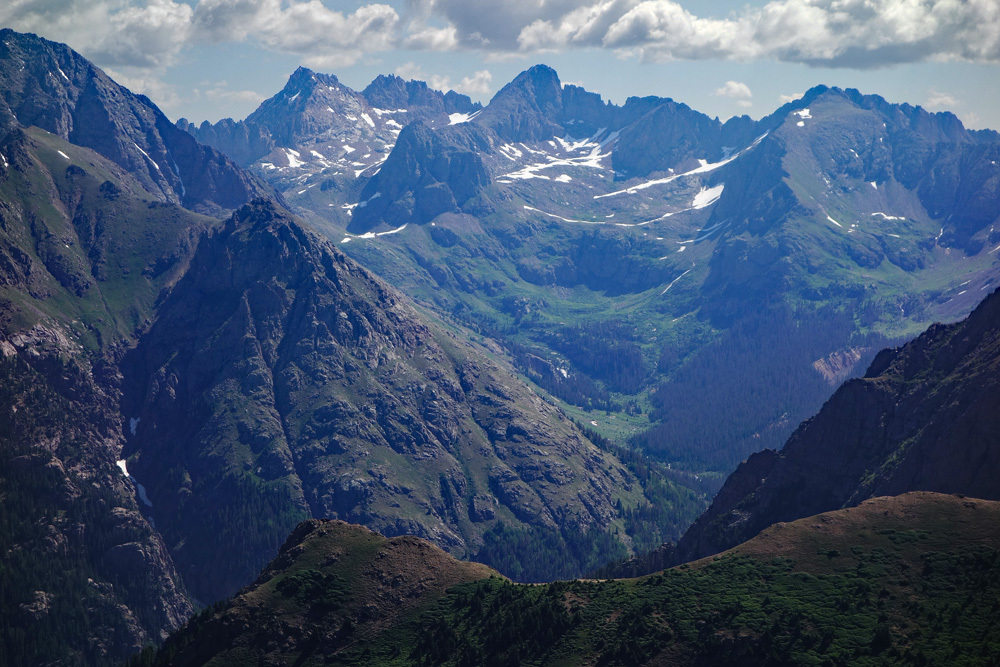
Overlook Point was considered the highest 12er in Colorado prior to Lidar re-evaluation which added seven feet in elevation, making this a ranked 13er. A moderately long but pleasant hike through mostly tundra country with abundant wildflowers leads to this Class 2 summit that offers a stunning view looking down into Needle Creek and the Chicago Basin area with the three 14ers located at the head. Access to the trailhead requires a lengthy drive on mostly graded dirt road from out of Durango.
Overlook Point Route
-
-
Lime Mesa - Overlook Point TH
To reach the Lime Mesa Trailhead, you need to access FR 682 on the east side of the Purgatoire River and north of Durango. We offer three ways to do that:
1. If driving south on US 550 and still well north of town, after passing turnoffs for Electra Lake and Haviland Lake, watch for a turnoff on the east side of the highway just a little over 8 miles south of the turnoff for Electra Lake. This turn accesses CR 250, aka: "East Animas Road." If you notice Pinkerton Hot Spring on the east side of the highway, you have gone past the turn by a few hundred yards. Turn east onto CR250 and follow it as it curves first north, then south and crosses Academy Drive, (a straight running north-south road). Continue on CR 250 across Academy Drive and 250 turns NNW to descend to the river crossing on what is called, "Baker's Bridge." This is a popular summer swimming and diving area where the river is pinched between rock outcrops. It's about .7 mile to the bridge crossing from US 550. Once across, the same road continues south, then west, then straight south again to a "T" junction where you must turn left or right. Head right/west here and follow the road which will soon turn back south again. Continue following CR 250 south until it comes to the intersection for FR 682 which turns sharply to the left and begins to angle uphill to the NNE. From the Baker's Bridge crossing, it's approximately 3.5 miles to this intersection.
2. Again, you'll be on US550 well north of Durango. For this access, turn east onto Trimble Lane, a well-marked road and intersection. Trimble Lane is also known as CR 252. Follow Trimble across the river and it will soon intersect CR 250., aka: East Animas Road. Go north on CR250 for about 3.75 miles to the intersection with FR682, where you will veer right to access this long, graded gravel road.
3. From the town of Durango, locate the City Market on the east side of US 550 and at the SE corner of US 550 and East 32nd St. Go east on E. 32nd for 1.5 miles, crossing the river and this city street will intersect CR 250, aka: East Animas Road. Make a left/north turn and drive appx. 10.7 miles north to the intersection with FR 682. Veer right to head up the graded, gravel forest road.
Once on FR682, aka: Missionary Ridge Road, drive 17.5 miles generally north to northeast to an intersection for Henderson Lake. FR682 initially climbs up the mountainside on an endless series of 11 switchbacks before it begins to level out some. When it does, you'll be driving through areas of the Missionary Ridge Fire of 2002 that charred 73,000 acres. The Henderson Lake turnoff is to the right after the tedious 17.5 miles of gravel road. Coordinates for this intersection are: N 37° 30' 41.13" W 107° 40' 50.47", 9,900 ft. elevation. This road is designated as FR 081. The road soon passes on the west side of Henderson Lake and continues through forest to the trailhead in about 5 miles. The last 2 miles become quite rough and slow with potholes. This is the portion that requires the higher clearance. The trailhead is designated by a split rail type fence marking an area off for parking. Plan on total drive time exceeding 1.5 hours.
Camping
There are limited camping opportunities at Henderson Lake and ample places at the trailhead. Along FR 081, there are also other primitive spots as well. The farther you get past Henderson Lake, ( a popular fishing location), the more likely you'll find an unoccupied spot.
Click thumbnail to view full-size photo + captionRoute Description
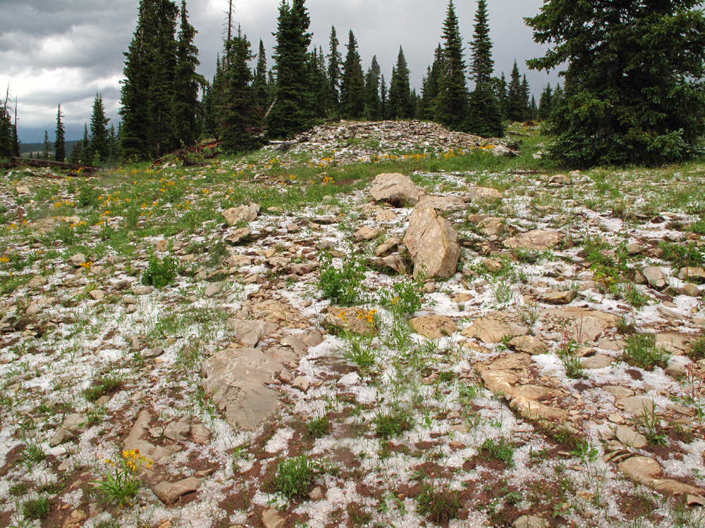
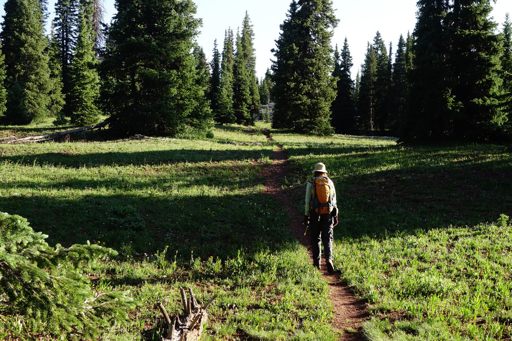
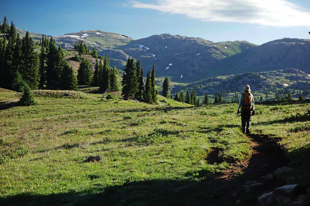
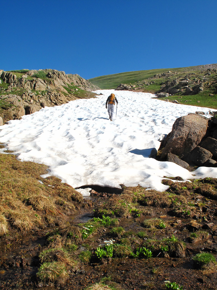
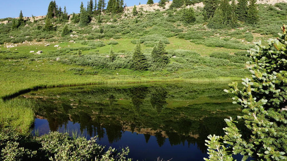
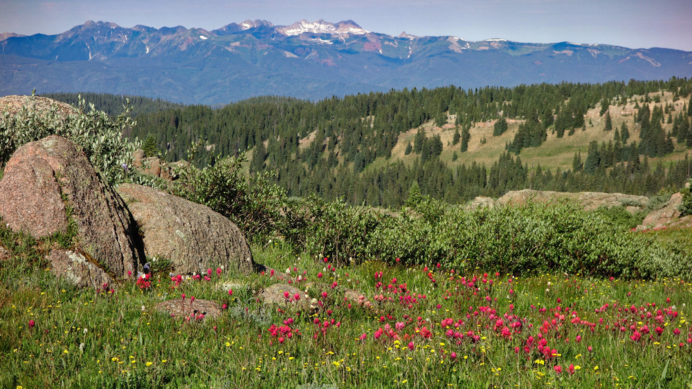
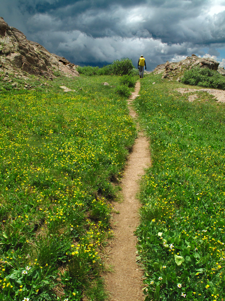
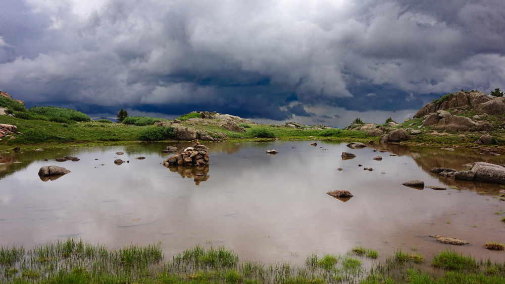
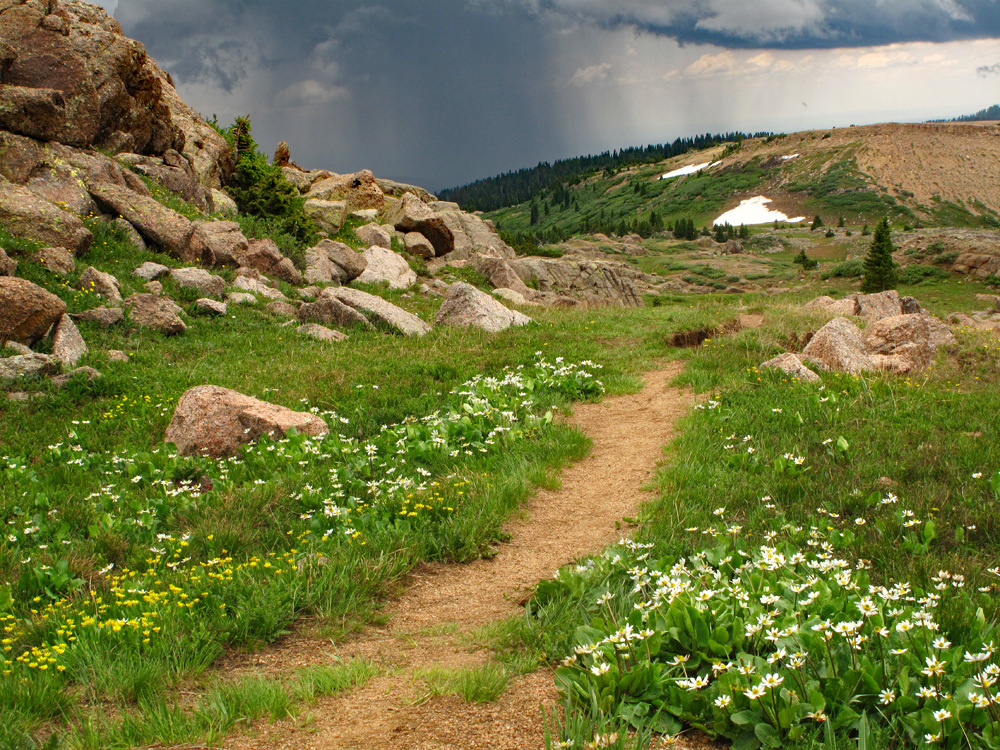
Year Climbed: 2017From the trailhead parking, the route to Overlook Point is quite simple. Hike north on the Lime Mesa Trail #676 for four miles to where the mesa suddenly drops off toward Ruby Lake. The trail begins as an old 4WD road which after a while degenerates to a trail. Five hundred feet in elevation are gained in the first mile, then things "level" from the next two miles with the remaining elevation gain occurring in the last mile up to the overlook of Ruby Lake and the final ridge to Overlook. The hiking is never particularly steep and some may want to reduce the mileage by veering NNW toward Overlook before arriving at the viewpoint overlooking Ruby Lake. The trail is never difficult to follow. The first couple miles pass through open conifer forest and pleasant, grassy meadows. When you come to Dollar Lake, (it's round like a silver dollar?) the terrain opens up into high tundra, with low willows and abundant wildflowers as it weaves between low rocky outcrops. In the distance, to the southwest can be seen the La Plata Mountains. The hiking here is easy and pleasant, however, there is not any cover for afternoon thunderstorms, which are quite likely here as you will see in some of the photos. After Dollar Lake, there may be a couple other small tarns.
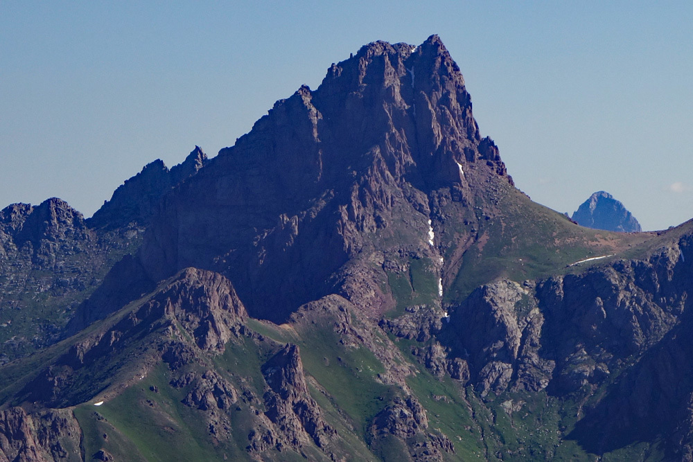
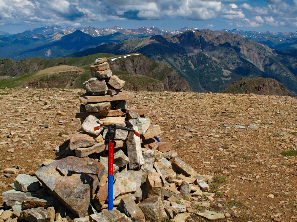
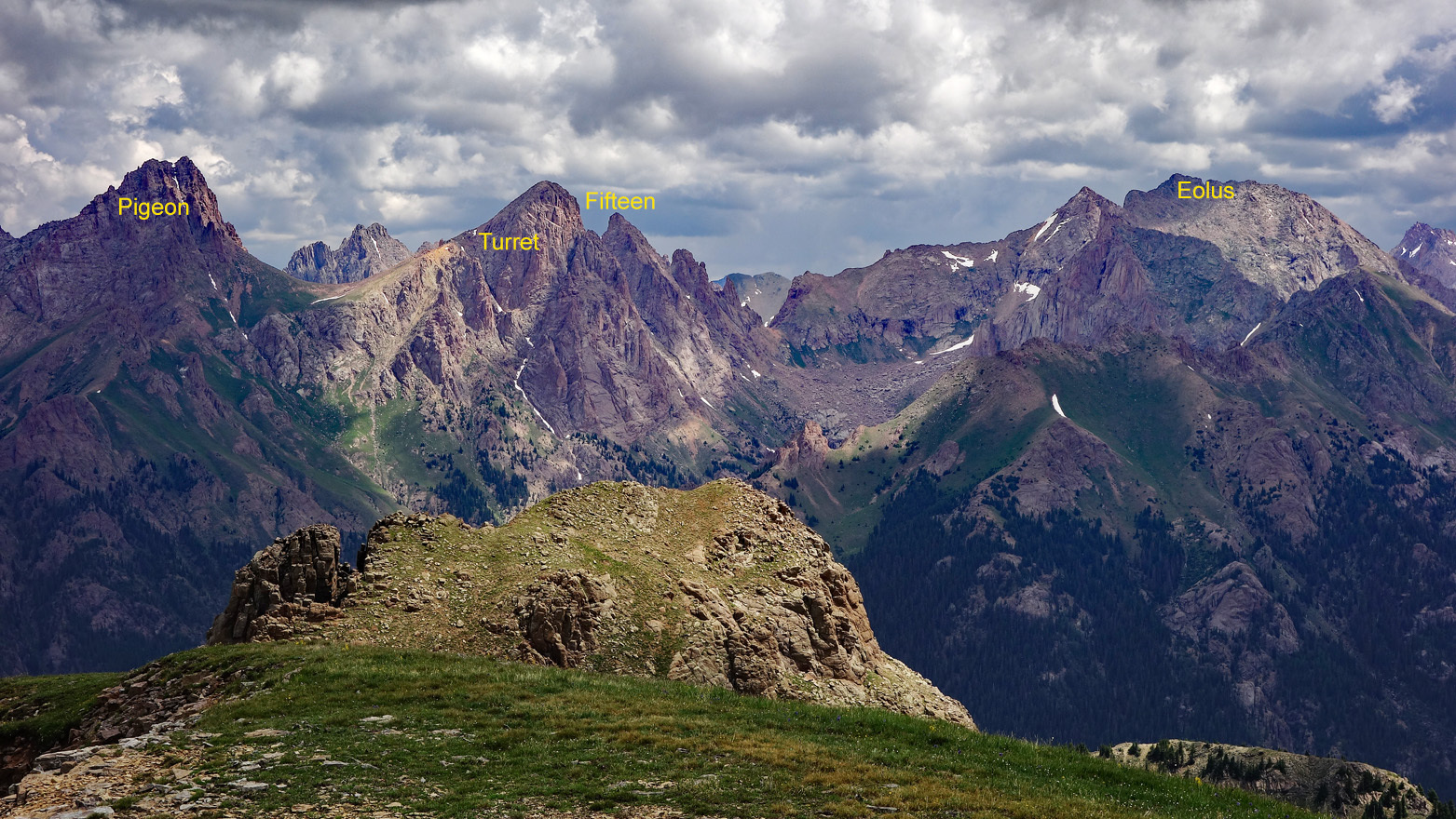
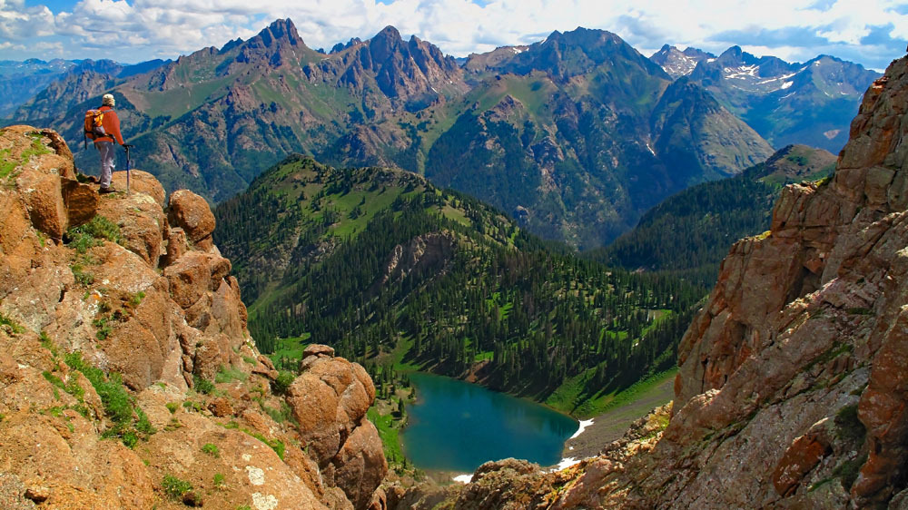
Once you reach the viewpoint of Ruby Lake, take a left turn and begin following the ridgeline NW, staying away from the cliffs on the right hand, going through a brief area of talus, passing over an unranked point (12, 825) followed by a descent across talus to a saddle, then the final gain to the summit of Overlook Point. This last saddle looks right down on Ruby Lake. The summit of Overlook turns to mostly small talus and gravel. From this summit, you'll enjoy and impressive view of Needle Creek, Chicago Basin and the three 14ers, plus Pigeon, Turret and Peak Fifteen - all very prominent 13ers located north.
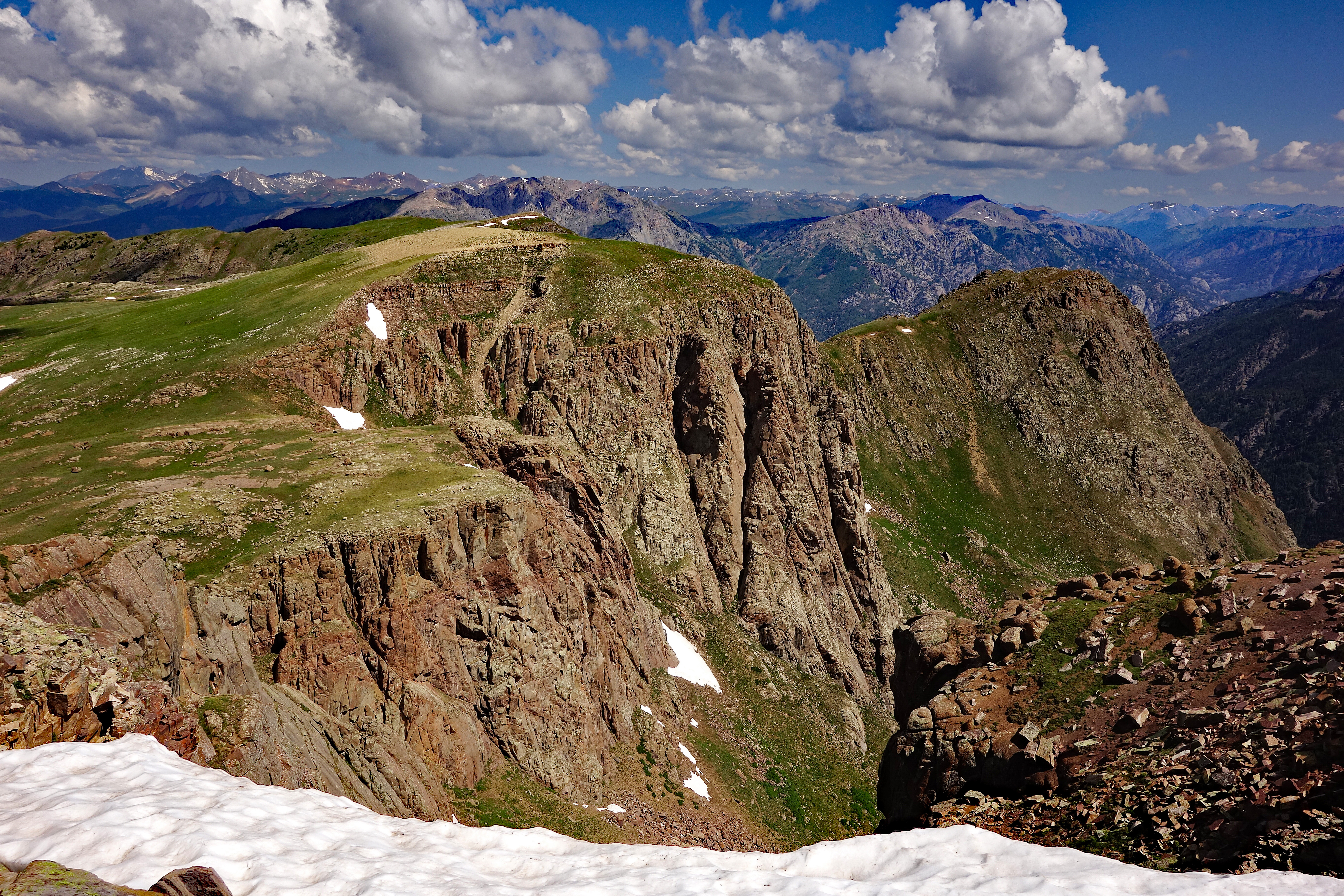
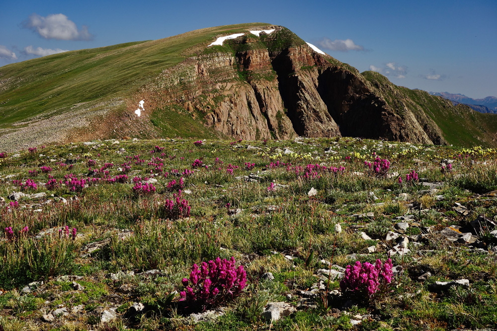
For those who might consider adding a 12er to their completion list, UN 12,748 lies about .8 mile to the NW. Descend the NW ridge of Overlook, dropping down to another saddle. This viewpoint saddle offers a great view of Pear Lake and some nice rocky cliffs to frame out the scene. This is a great photo op. Reaching this additional summit will take little time because the terrain remains mostly tundra with a small amount of talus/gravel and a summit similar to Overlook. From here, you can make a beeline to the SE, cutting across the south facing slopes of Overlook to reconnect with the trail for the return trip. Throughout this hike, you will be in prime elk habitat. Keep an eye out and enjoy the many distant vistas this hike offers.
Additional BETA
Links to other information, routes & trip reports for this peak that may be helpful. -