LoJ: #68 (Pre-LiDAR #72) / 13,918' Horseshoe Mountain
Peak Summary
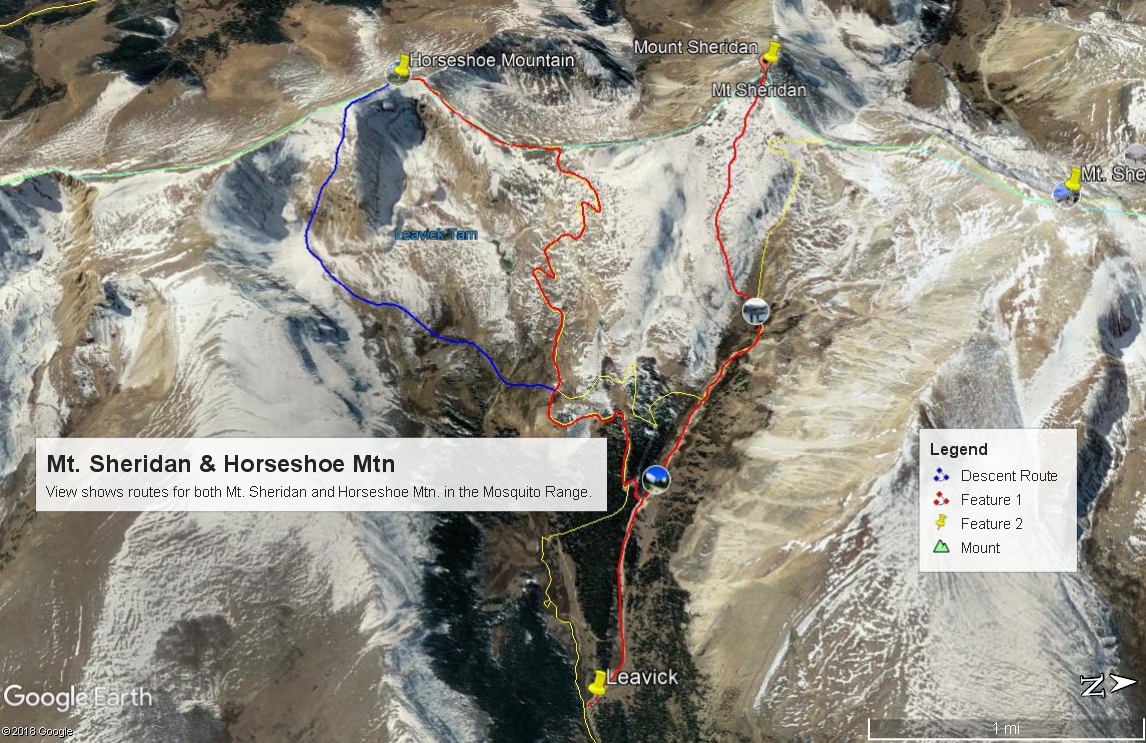
Horseshoe Mountain is an easy Class 2 hike from the Fourmile Creek-Leavick trailhead on the east side of the Mosquito Range. Much of the gentle route utilizes old mining roads. Horseshoe can be combined easily with Mt. Sheridan by way of the connecting ridge. The trailhead is accessible by passenger vehicles. Close proximity to the Front Range makes this hike an excellent family adventure for those who reside on the eastern slope.
Horseshoe Mtn. NE Ridge Route
-
-
Fourmile-Leavick TH
From the intersection of US 285 and SH 9 at Fairplay, drive south on US 285 for one mile to CR 18. Turn west onto the county road. In about four miles, you'll come to National Forest land. Drive west past the Horseshoe CG , then the Fourmile CG. Both are rather small and have limited number of sites. 2.5 miles past the turnoff for the Fourmile CG you'll arrive at the old mining townsite of Leavick where there are still some old buildings. Park in this vicinity for passenger vehicles. 4WD may be able to continue up the road as much as another two miles. Much of the land around here is privately held, mostly old mining claims. Respect any private property postings. Mt. Sheridan is on privately held land. Much of the route up to Mt. Sherman is also on privately held land. Fortunately, at this point, there have been no attempts to block access to these peaks.
Camping
As mentioned above, there are two National Forest Campgrounds on the drive in - the Horseshoe and the Fourmile. It appears that the Fourmile CG is always first-come, first-served while the Horseshoe has sites that can be reserved on Recreation.gov during the "reservation season." Other than these two campgrounds, you may find a primitive site on the north side of CR 18 at Horseshoe and some other primitive sites on the south side of the road, a short distance back east from Horseshoe CG.
Click thumbnail to view full-size photo + captionRoute Description
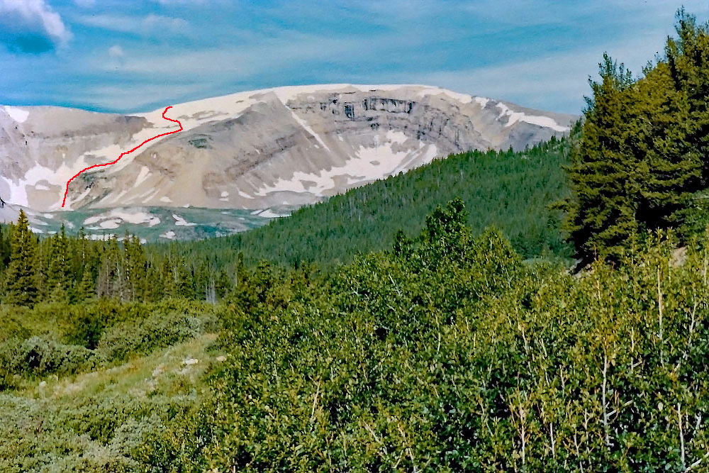
Year Climbed: 1986The route we suggest follows old mining roads all the way to the Horseshoe-Peerless saddle. This route is really Class 1 to the summit, but if you use our suggested descent route, it becomes a Class 2 route. Mileage and elevation gain assume a walking start from Leavick. Use of 4WD can shorten the mileage considerably depending on how far up you drive. It's possible to go as high as 13,200 ft. We first climbed Horseshoe in 1986. This may have been one of our earliest 13ers. Bob Alden, who had completed the 14ers in 1983, was looking for partners to do Horseshoe and prevailed upon us to accompany him on Memorial Day weekend. We took our cross country skis and enjoyed a long and easily manageable snow descent by following the descent route described below.
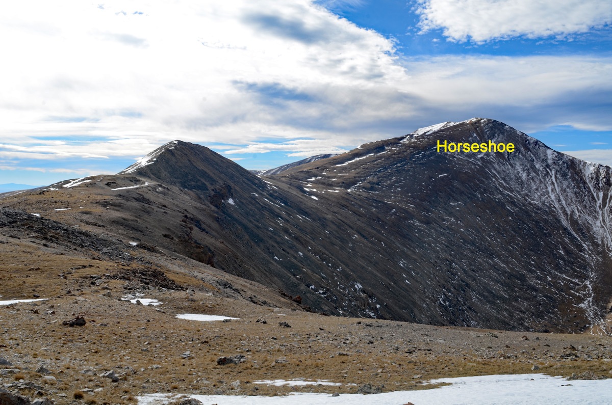
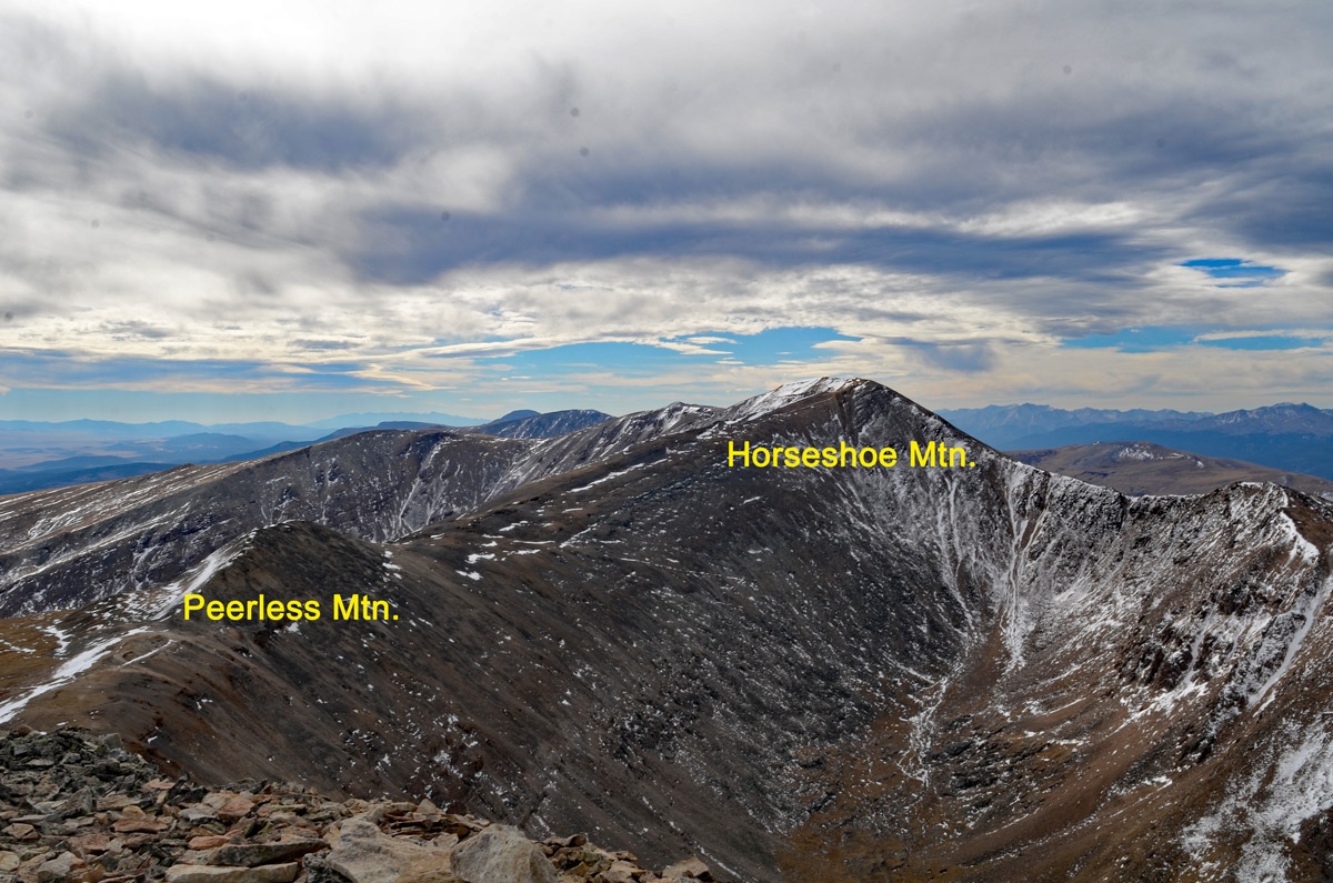
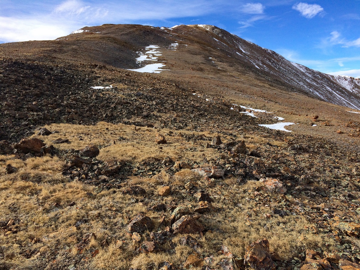
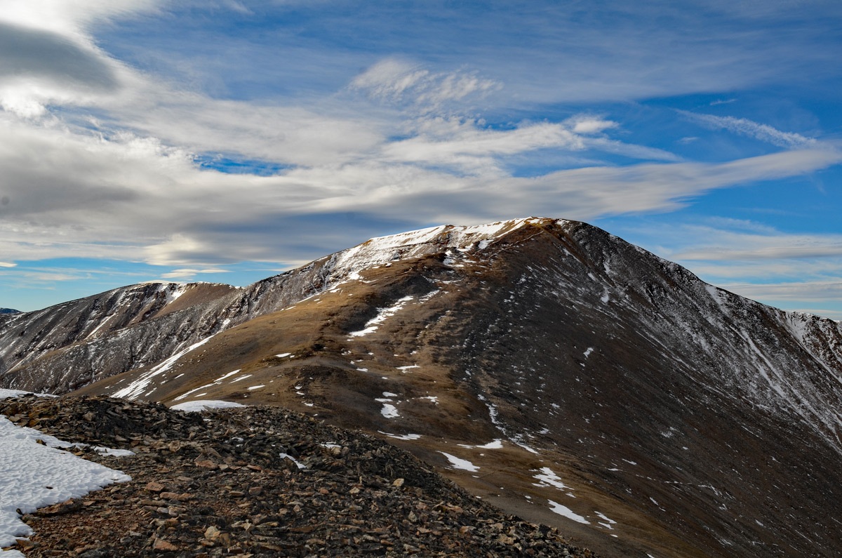
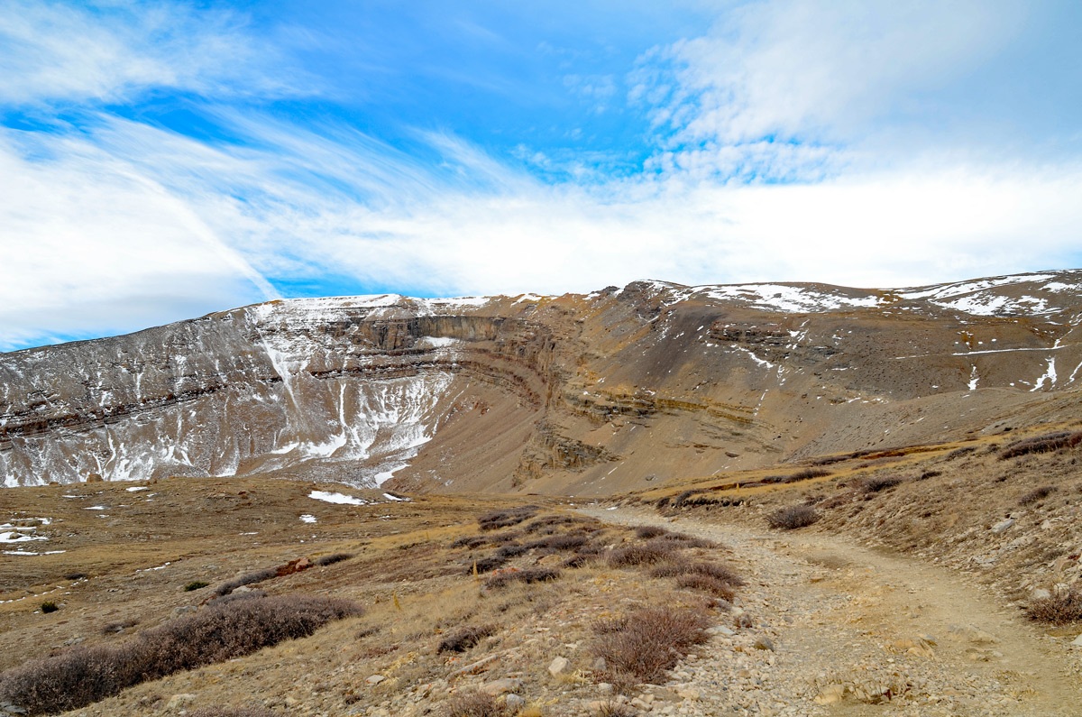
Either park at Leavick as described in the trailhead information or drive an additional .75 mile up the road to where a 4WD road turns off on the left at the 11,588 ft. marker on the USGS quad. There's a little bit of parking just before the turnoff and 2WD vehicles can usually make it to that point. Hike on up the 4WD road which changes directions and switchbacks frequently. At 12,600 ft., you'll begin to encounter some mining ruins and farther up toward the saddle, you'll pass by what's left of the Peerless Mine. Once you arrive at the Peerless-Horseshoe saddle, simply turn south and follow the ridge to the summit. You should find a trail leading there. The upper terrain is mostly tundra with some chiprock-scree mix. The road tends to be gravel or some tedious chiprock and small rubble at times. Enjoy the summit view. Watch out for those infamous Tenmile-Mosquito Range winds and return as you came unless you're looking for more adventure. Distance from the start is 4.9 miles. If you use the descent we describe below, it will shorten the return mileage a little.
For a Class 2 descent, head south from the summit until you're past where the broad and prominent east ridge intersects the south ridge. Head on down into the basin below to the ESE on talus, scree and sparse tundra and locate a way to get down to the lower basin at 12,400 ft. If you swing more center in the drainage, you can avoid some brief, rocky couloirs. Once down to 12,400 feet, things level out quite a bit and talus gives way to easier terrain. Head in a generally NNE direction, gradually descending across tundra, grass and lower down, passing through some willows. You'll be passing on the east side of and about a half mile down from the two unnamed lakes that sit below the main "horseshoe" basin of the mountain. Cross the creek that drains the northernmost of the two lakes and either go uphill just a little or contour to regain the 4WD road used in the morning at about 12,000 ft. Walk on back to wherever you left your vehicle. In late spring/early summer, this route down can be skied for much of the descent. We actually used some backcountry, free-hill skis, but they did not handle all the suncups very well.
Additional BETA
Links to other information, routes & trip reports for this peak that may be helpful. -